
HG-iSpectra-UAV
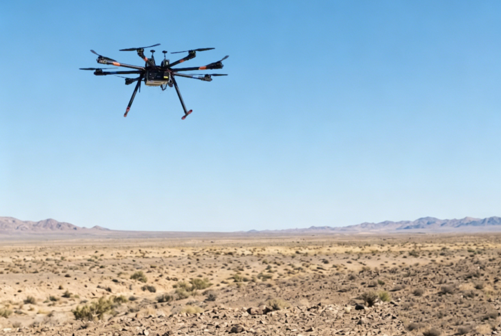
UAV-Borne Field Spectroradiometer System
Large-Scale Surface Feature Spectral Data Acquisition · Airborne Stabilized Observation System
An airborne spectral remote sensing observation system engineered for agricultural monitoring, ecological environments, and resource investigations, enabling rapid spectral acquisition and multi-scale information inversion of surface targets.
Product Introduction
The HG-iSpectra-UAV UAV-borne field spectroradiometer system is an airborne remote sensing observation instrument based on unmanned aerial vehicle platforms. It integrates a surface feature spectral sensor, a stabilized gimbal system, a data acquisition module, and a wireless transmission system to achieve rapid, highly efficient, non-contact spectral information acquisition of ground targets.
By being deployed on multi-rotor or VTOL (Vertical Take-Off and Landing) UAV platforms, the system can perform low-altitude spectral radiometric scanning over ground targets, capturing continuous spectral data across the visible, near-infrared, and short-wave infrared bands. This data is utilized to mathematically invert physical, chemical, and biological characteristic parameters of the surface features.
Compared to traditional ground-based measurement methods, the HG-iSpectra-UAV system offers superior mobility, broad coverage, and exceptionally high data collection efficiency, allowing it to complete large-scale regional spectral collection tasks within compressed timeframes. It is widely utilized in precision agriculture monitoring, ecological environment investigations, mineral resource exploration, water body analysis, and remote sensing data validation. Furthermore, it serves as a crucial cross-scale bridge connecting satellite remote sensing with ground observations to realize multi-platform collaborative workflows.
Technical Features
Airborne Integration
Lightweight structural design, highly compatible with multi-rotor and VTOL UAV platforms
Configurable Wide Spectrum
Supports flexible customization across visible, near-infrared, and short-wave infrared bands
Stabilized Gimbal
Dynamic attitude compensation to fully ensure measurement and scanning stability
Real-Time Transmission
Supports synchronous data acquisition and real-time backhaul to ground stations
GNSS Synchronization
Integrated high-precision satellite positioning and hardware-level time synchronization
Modular Expansion
Supports secondary expansion of multi-sensor configurations and functional modules
Application Fields
Precision Agricultural Monitoring
Ecological Environment Surveys
Soil & Surface Feature Analysis
Water Body Environment Monitoring
Mineral & Resource Exploration
Remote Sensing Calibration & Validation (Cal/Val)
Technical Specifications
| Parameter | Technical Specifications |
| Spectral Range | 400–2500 nm (Customizable bands) |
| Spectral Resolution | 2–6 nm |
| Spectral Channels | 2151 |
| Field of View (FOV) | 4°–25° optional (Based on lens configuration) |
| Imaging Methodology | Push-broom scanning / Point-based spectral acquisition |
| Spectral Accuracy | ±0.5 nm |
| Ground Resolution | Centimeter to decimeter level (Depending on flight altitude) |
| GNSS Accuracy | Horizontal ≤ 1.5 m (Centimeter-level achievable with RTK) |
| Attitude Stability | ≤ 0.1° (Post-gimbal compensation) |
| Data Processing | Real-time spectral analysis and automated reflectance inversion |
| Algorithm Support | Vegetation index computation, target classification, anomaly identification |
| Software Platform | UAV-borne hyperspectral data processing software package |
| Data Interface | WiFi / 5G / Dedicated telemetry datalink |
| Automated Features | Automatic collection, automatic positioning, hardware geo-synchronization |
| Gimbal System | 3-axis actively stabilized compensation gimbal |
| Operation Mode | Airborne low-altitude continuous observation |
| Working Environment | -10°C to 50°C rugged outdoor complex environments |
| Power Requirements | UAV flight battery integration or independent battery module |
| System Expansion | Supports payload customization and secondary platform integration |
| Customization Ability | Supports task scenarios and targeted algorithm engineering customization |
Want to learn more about our UAV-Borne Spectroradiometer Systems?
Our engineering team will comprehensively provide you with professional product consultation, solution design, and technical support services.
WeChat

Contact Us
Hagorun Technology Limited | Focus · Dedication · Exploration · Vision