HG-HyperUAV
UAV-Borne Hyperspectral Imaging System
High Spectral Resolution & SNR · Supports Multi-Band Configuration · Multi-Platform Airborne Hyperspectral Remote Sensing Solution
A high-performance hyperspectral imaging system suitable for multiple platforms including UAVs, manned aircraft, and laboratories, providing a complete suite of hyperspectral data acquisition and processing software.
Product Introduction
The HG-HyperUAV series high-performance hyperspectral imaging system features high spectral resolution, wide dynamic range, high signal-to-noise ratio (SNR), and low distortion. It is perfectly suited for hyperspectral data measurement needs across different platforms including fields, laboratories, and airborne applications, enabling a wide range of applications such as precision agriculture, fruit detection, mineral analysis, and target classification and identification.
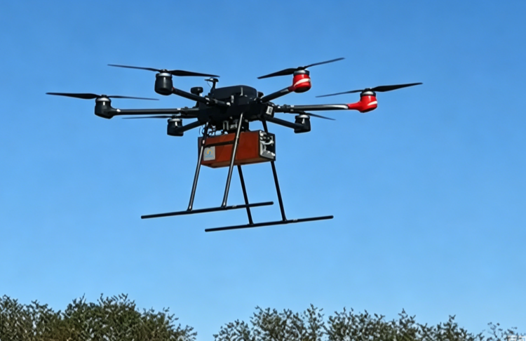
To meet the airborne hyperspectral data collection demands for both unmanned and manned aircraft, Hagorun Technology Limited provides a series of airborne solution packages optimized for the HG-HyperUAV series imaging spectrometers. These cater to hyperspectral data acquisition requirements across various wavelength bands, including 400–1000nm, 1000–2500nm, and 400–2500nm. The system can be mounted on multi-rotor UAVs, fixed-wing aircraft, or integrated into various aviation platforms like manned aircraft and motorized hang gliders. This significantly enhances the efficiency and coverage of airborne remote sensing, meeting the high-efficiency measurement needs under diverse flight platforms and complex scenarios.
In addition to the aforementioned features, the HG-HyperUAV airborne hyperspectral measurement system offers a variety of airborne data post-processing software packages, allowing users to easily achieve geometric correction, atmospheric correction, and other processing needs. We provide users with complete airborne hyperspectral data measurement turnkey solutions, and can also deliver customized application designs based on individual user requirements, thereby helping users realize a one-stop solution from hardware integration and data acquisition to software processing.
Technical Features
High Resolution
High spectral and high spatial resolution imaging
High Frame Rate & SNR
High signal-to-noise ratio and fast data acquisition
Optional Wide Spectral Bands
Supports multi-band spectral range configuration
Multi-UAV Platform Compatibility
Supports multi-rotor, fixed-wing, and manned aircraft
Complete Acquisition & Processing Software
Data acquisition, radiometric, geometric, and atmospheric correction
Customized Development
Supports customized services for various application scenarios
Application Fields
Precision Agriculture & Crop Monitoring
Fruit Detection & Quality Analysis
Geological Exploration & Mineral Identification
Remote Sensing Surveying & Environmental Monitoring
Land Resources Monitoring & Assessment
Target Classification & Precise Identification
Technical Specifications
| Item | HG-HyperUAV10 | HG-HyperUAV15 | HG-HyperUAV25 |
| Field of View (FOV) | 20° Standard, other FOVs customizable | ||
| Scan Type | Push-broom Imaging | ||
| Wavelength Range | 400nm – 1000nm | 1000nm – 2500nm | 400nm – 2500nm |
| Spectral Resolution | ≤3.0nm | ≤6.5nm | 3.5nm ~ 6.5nm |
| Spectral Channels | 400 | 320 | 480 |
| Spatial Pixels | 1240 | 620 | 620 |
| Digitization | 12bit | 16bit | 16bit |
| Detector Type | Si CCD | MCT | Si CCD + MCT |
| Frame Rate | 150Hz | ||
| Dimensions | 230×197×150 mm | 255×199×180 mm | 380×210×185 mm |
| Weight | 3.0kg | 4.5kg | 6.0kg |
Want to learn more detailed information about our UAV Hyperspectral Imaging Systems?
Our engineering team will comprehensively provide you with professional product consultation, solution design, and technical support services.
WeChat

contact us
Hagorun Technology Limited | Focus · Dedication · Exploration · Vision